
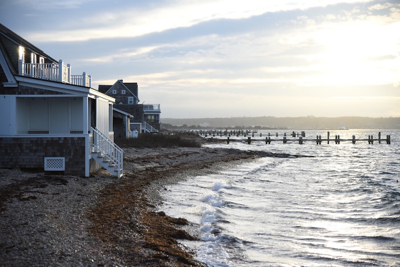
Rising seas will pose a significant threat to the areas around Oak Bluffs Harbor, Crystal Lake, the Martha’s Vineyard Hospital and other locations in Oak Bluffs, according to a detailed report and adaptation plan prepared for the town.
The sea level in Oak Bluffs will increase up to two thirds of a foot by 2030, and up to 3.39 feet by 2070, according to the report, which notes a rapid increase in global mean sea level in the last century, and an even sharper increase projected for the future as a result of global warming caused by greenhouse gas emissions.

The Coastal Vulnerability Assessment and Adaptation Plan, produced by the engineering firm Kleinfelder, along with scientists at the Woods Hole Group, is the first of its kind for the Island, identifying the areas most at risk in Oak Bluffs, and laying a foundation for future projects and planning along the shoreline.
“We all know the impacts of climate change have begun and will be getting more and more severe,” said Oak Bluffs conservation agent Liz Durkee, who spearheaded the efforts two years ago and helped oversee the process with other town officials. “It’s very important to me to be prepared for that and to have a plan.”
Voters in 2014 appropriated $50,000 in community preservation funds for the project, which assesses the town’s vulnerability to future sea level rise and storm surges associated with extreme weather events, and identifies strategies for adapting to the risk. The report focuses mostly on municipal infrastructure such as roads and bridges, along with schools, public safety facilities and other town-owned buildings.
Completed in July, the final report identifies four low-lying areas most at risk: Oak Bluffs Harbor, Crystal Lake and the area around the hospital, the area around Farm Pond, and the area around Sengekontacket Pond and Joseph Sylvia State Beach. Project manager Andre Martecchini of Kleinfelder said those areas already tend to flood during severe storms, but that the flooding will only get worse. He also noted that the town’s relatively steep coastal bank limits the total inland area that is vulnerable to flooding.
A series of maps shows projected inundation zones based on a range of probabilities for both 2030 and 2070, with even the more common storm events projected to cause flooding hundreds of feet inland. For the year 2030, for example, the report projects at least a 10 per cent chance of flooding past East Chop Drive along the harbor, and more than quarter mile south beyond Sunset Lake. A similar flood would likely inundate Beach Road and Eastville avenue to the west, isolating the hospital, which would occupy a small peninsula accessible only by Temahigan avenue to the north.
The level of risk in each area was determined by both the likelihood of flooding and the consequences of infrastructure failure in a given year.

“The harbor is a particularly vulnerable area,” Mr. Martecchini said. “Unfortunately, it’s your commercial center, so if you lose the harbor business, it will have an economic impact on the whole town, [in terms of] employment and tourism and everything else.”
Oak Bluffs shellfish constable David Grunden, who served with Mrs. Durkee and others on a steering committee while the project was underway, added that increased flooding could either benefit or harm shellfish populations in coastal ponds, but that he couldn’t predict the outcome. Shellfish might end up with more habitat, he said, although the loss of State Beach, for example, could turn Sengekontacket Pond into an embayment. “It would drastically change what we could grow,” he said.
The report includes a number of strategies for adapting to the changes, including flood barriers, artificial dunes, beach nourishment, raised infrastructure and town policies to encourage smarter development in flood-prone areas. But some of the areas most at risk may also be the most expensive to protect.
“I don’t think any of the options are going to be easy,” Mr. Grunden said. “A lot of them will be too expensive to do anything with. But there are some decisions that will have to be made in the next five to 10 years.”
Mrs. Durkee agreed that at least some of the recommendations would be out of reach financially. “A lot of these projects are so expensive that it’s a challenge to look for funding,” she said. But she added: “Having the vulnerability assessment plan done will help us in applying for grants, because we will have documented the need.”
The town has not set aside money to pursue the recommendations, although at least two other coastal projects are already in the works, with efforts to stabilize the East Chop Bluff and to replenish a long stretch of beach, including the area where the new North Bluff seawall was installed last year. “Once we get further along in those projects, then we will be able to take a deep breath and look at the coastal vulnerability problems and really start to prioritize where we want to go from there,” Mrs. Durkee said.
The coastal vulnerability plan also includes a number of lower-cost solutions such as installing a tide gauge in the harbor to monitor actual sea level rise, elevating town sewer pumps, and flood-proofing the police station, which by 2070 would be vulnerable to a 100-year flood, according to the projections. Along those lines, the town has already elevated a generator at its pump station on School street for a relatively low cost.
Looking ahead, Mr. Martecchini noted that immediate action might not always be necessary, but he said the report sets the stage for longer-term planning, as town buildings and roads are eventually replaced. “You should really think very hard about how you are going to build it the next time around,” he said.
Mrs. Durkee hopes to arrange a meeting with Mr. Martecchini and the town selectmen this year to help publicize the report. Mr. Martecchini unveiled his preliminary findings at a well-attended public meeting in 2015, and also spoke at the Martha’s Vineyard Coastal Conference last year. Among other things, he noted the strong support of town officials in Oak Bluffs over the last two years, which he said isn’t always the case.
“Some towns try to do it and if people don’t really get behind it, it may not go anywhere,” he said of the assessment and planning process. “I think that’s important to know. The leadership was behind this and that’s a good sign.”


Comments (5)
Comments
Comment policy »