
Drinking water on Martha’s Vineyard could be in jeopardy in the coming decades.
As climate change intensifies and the ocean around the Vineyard rises, scientists and Island officials are concerned that salt water could permeate through the Island’s ground water, threatening the potability of its only source of drinking water.
To get a better understanding of how vulnerable the Island’s fresh water is, the United States Geological Survey is studying the Vineyard watershed and working on a model to predict how the water beneath Islanders’ feet will flow. The information will help guide local water management practices and prepare ecologists for potential changes to the Island’s ponds and wildlife.

“Martha’s Vineyard’s coastal aquifer is really susceptible to sea level rise and climate change,” said Timothy McCobb, a hydrologist with the USGS New England Water Science Center. “I’ve been wanting to do this research for years because we really should be finding out just how threatened this Island is.”
The mission, said Mr. McCobb, is to measure the depth of the Island’s bedrock and locate where fresh water and salt water may meet as seas rise.
The majority of the Vineyard’s drinking water is sourced from a large aquifer that formed an estimated 20,000 years ago from underground streams of glacial runoff. When rain falls and seeps through the soil, the aquifer is replenished and, with the help of testing and treatments by water districts, the fresh water remains drinkable.
But the United Nations’ Intergovernmental Panel on Climate Change predicts that the sea around the Island could rise between 1 and 6 feet in the next eight decades — a potentially-disastrous forecast for this valuable system and the Vineyard’s habitability.
This ground water system will be reflected in a digital model created by Mr. McCobb and his research team. When completed, the model will predict how the Island’s aquifer will react to a variety of potential shifts in the local climate.
“When we get our model in place, we can use it to look at best- and worst-case scenarios when it comes to climate change,” said Mr. McCobb. “If [water districts] tell us what their pumping rates and locations are, we can put that into the model and say, okay here’s what you can expect.”
The model work started last fall, and is expected to take about three years to finish.
After securing funding from the Massachusetts Department of Environmental Protection last fall, Mr. McCobb and his crew got to work gathering fieldwork equipment and compiling data from similar previous studies conducted on Cape Cod.
In May, they ventured to the Vineyard from the science center’s headquarters in Northborough for an intensive five-day research trip.
Islanders are also playing a part in the project.
David Bouck, director of science and collaboration at the Great Pond Foundation in Edgartown, helped the researchers gain access to properties where they could conduct a seismic testing technique to calculate the depth of the bedrock. They also used an electromagnetic survey to sense salinity levels and identify aquifer materials.
“Ideally, with these methods, you need a lot of open space, like a nice wide field that’s not near any power lines or any heavy development that could interfere with their analysis,” said Mr. Bouck.
One property that fit the bill was Milkweed Farm in Chilmark, said Mr. McCobb.
After getting a thumbs up from owner Mallory Watts, the team transformed the farm into their temporary research lab. To locate where the fresh water and salt water meet underground, they used a seismic instrument that shoots electrical currents into the earth, explained Mr. McCobb. The device can sense resistance in the ground and, in turn, find where the waters start to mix.
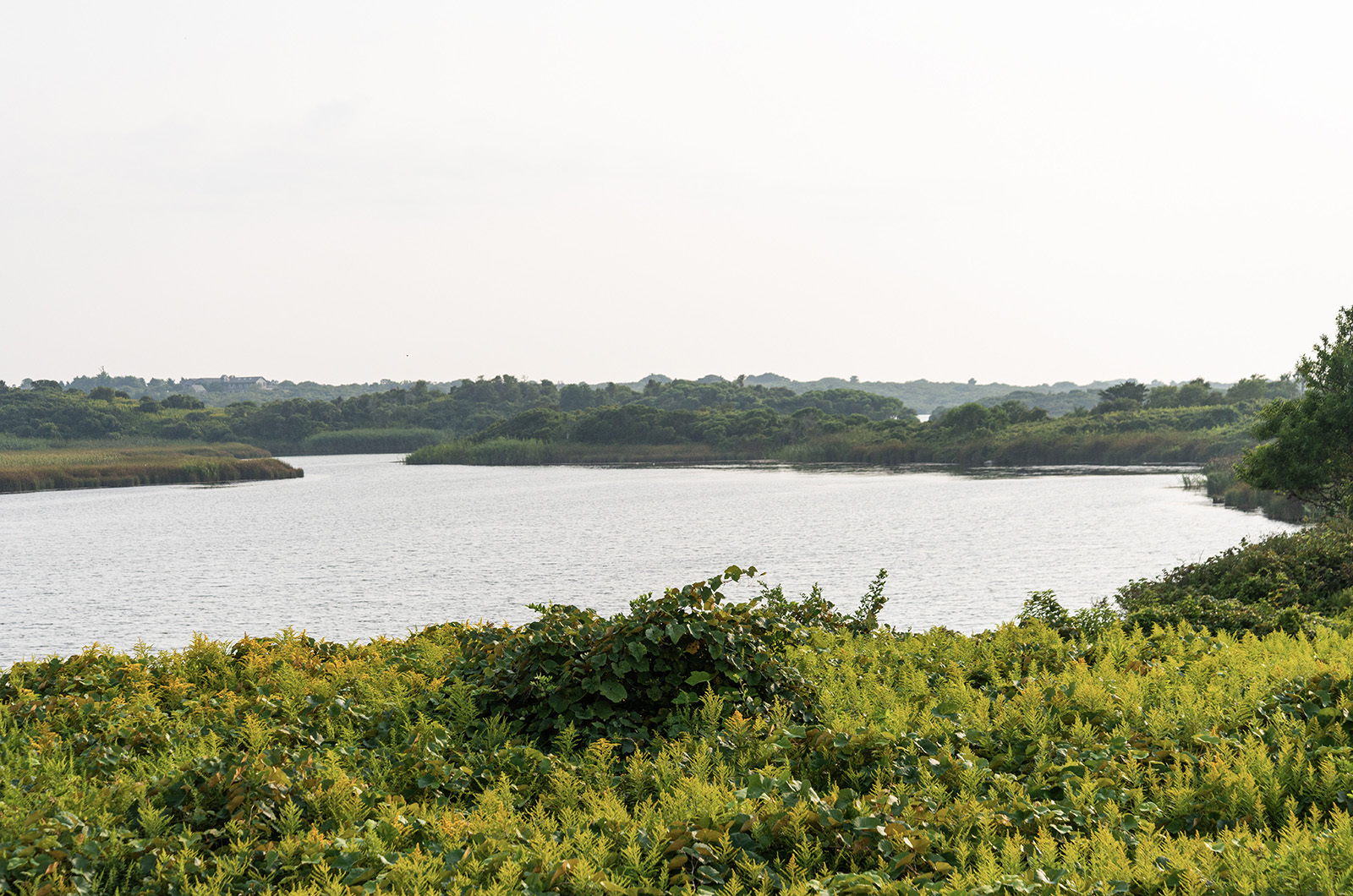
The crew also spent some time out on the water at Squibnocket Pond with scientists from the Wampanoag Environmental Laboratory. There, they measured the water’s salinity levels and searched for places where fresh water seeps into the brackish pond to better understand the area’s water table.
The lab’s manager, Andrew Jacobs, said that the USGS research will help him know more about the pond’s ecosystem and its vulnerability to rising sea levels. A change in salinity, he said, will inevitably affect the pond’s inhabitants.
“Their work significantly ties into a herring project that we’ve been involved with for a number of years,” said Mr. Jacobs. “We’re trying to understand habitat availability and the water quality, and how it all affects the fish.”
Emily Reddington, executive director of the Great Pond Foundation, echoed Mr. Jacobs sentiment, and said that understanding the dynamics of the Island’s waters and the changing climate is key to the survival of the community’s people, plants and animals.
“We have a lot of work to do to combat whichever scenario will actually happen,” she said. “Ground water is our only source of drinking water, and it is very shallow here. So, it’s extremely timely that Tim and his team are doing this work. It’s essential to the long-term sustainability of the Island.”
Both organizations, and others around the Island that frequently conduct water quality testing at ponds and wells, are regularly supplying the USGS science center with data from their surveys while the team works from Northborough. The researchers have also been partnering with the Martha’s Vineyard Land Bank, The Trustees of Reservations, The Nature Conservancy and Sheriff’s Meadow Foundation to access areas of the Island to perform fieldwork.
Mr. McCobb said that they plan to return to the Vineyard in October to pick up their on-Island investigation. For now, he welcomes information from any Islanders who are routinely monitoring their well’s water level and quality.
Once the model is finished, it will be publicly available and converted into a comprehensive report to inform water suppliers and marine ecologists in their efforts to protect the Island from the rising ocean.


Comments (4)
Comments
Comment policy »