


In an attempt to quantify the Vineyard deer population, a Mount Holyoke College professor flew across the Island last Friday afternoon taking thousands of aerial infrared photographs for a tick-borne illness study. While a snowy, 20 degree day on Martha’s Vineyard may not be most visitors’ optimal conditions for a flight around the Island, professor of geography Thomas Millette deemed Friday’s weather ideal. A frozen ground, calm winds and an overcast sky all optimize the efficiency of the thermal imaging system developed by Mr. Millette.
For three hours Mr. Millette, along with research associate Dana Slaymaker and pilot Rich MacIsaac from the North Hampton Aeronautics Airport, flew in a racetrack-like fashion around the Vineyard, sampling about 20 per cent of the land.
Alongside the thermal imaging camera was a high resolution color camera, a LIDAR instrument, which records the
elevation of the airplane every time a picture is taken, and an altitude heading reference system. The instruments help plot the exact location where each photograph was taken.
In the images, the snow-covered ground transforms into a black pit with heat sources such as deer emerging as white spots.
Back at the lab, Mr. Millette will flip through the 10,000 or so black and white thermal images, referencing the color image when a white spot appears. He said the trouble with deer is that they do not like cold weather, and could hunker down for warmth among the trees, making it difficult for the thermal imaging system to pick up the heat source. But after three days of snow, Mr. Millette hoped the deer would be on the search for food.
A public health initiative instigated the deer census as part of its five-year study funded by a $250,000 state-mandated grant through the Martha’s Vineyard Hospital. The initiative is led by Edgartown health agent Matt Poole and Tisbury board of health member Michael Loberg as chairmen. It focuses on prevention, education and improved data collection for tick-borne diseases on Martha’s Vineyard.
“We are curious about the potential relationship between the deer and tick populations,” Mr. Poole said.
Using the thermal images, the initiative hopes to more accurately calculate the number of deer on the Island, as well as define densely-populated areas.
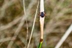
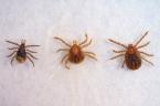
“When deer get too dense, ticks get dense as well,” said Sam R. Telford 3rd, a professor of infectious diseases at Tufts University and consultant for the initiative. “Adult deer ticks feed on deer primarily. Each fed female tick will lay 2,000 eggs. I’ve counted as many as 300 ticks on a deer. You don’t have to be a mathematician to calculate how many ticks will be on a single deer.”
“We are data-driven,” Mr. Loberg said. “We are trying to get a real number on the deer herd.”
Martha’s Vineyard and Nantucket host the highest deer populations in the state at an estimated 45 to 55 per square mile, according to David Stainbrook, the deer and moose project leader at the Massachusetts Division of Fisheries and Wildlife. The state agency currently calculates deer populations based on demographic information gathered from hunting check-in stations, including antler diameter, age, weight and total harvest numbers, Mr. Stainbrook said. The thermal imaging has not been used to quantify deer populations elsewhere in the state, he added.
As of Tuesday, Mr. Millette had analyzed a flight line of photographs to test the quality of the images.
“We saw horses, alpaca and even deer, thankfully,” he said.
He will calculate the herd density by the quantity of deer per area covered. The infrared photographs will also help distinguish deer hangouts.
“What’s interesting to us is the possibility of identifying sites where deer are spending a lot of time,” Mr. Telford said. “Then we can map those locations and see if there are lots and lots of ticks.”


Comments
Comment policy »